Audio tour New Dutch Water Defence Line
Walk past hidden Unesco World Heritage at USP

Fort Hoofddijk in the Botanical Gardens. Photo: DUB
Few UU members are likely to realise that they are in the vicinity of a Unesco World Heritage Site every day when they go to work or study at Utrecht Science Park (USP). Yet this concrete desert is home to a remarkable piece of Dutch history.
Part of the New Dutch Water Defence Line runs right through the university campus, with Fort Hoofddijk in the Botanical Gardens and Fort bij Rijnauwen in Bunnik, adjacent to the USP. In 2021, the New Dutch Water Defence Line was added to the World Heritage List of Unesco, the United Nations Educational, Scientific & Cultural Organisation.
The new audio tour World Heritage at Utrecht Science Park tells the story of the Dutch Water Defence Line. The province of Utrecht commissioned Utrecht Time Machine, which created the walking route in collaboration with Utrecht University (UU) and the Utrecht Archives.
Defensive works in the landscape
On a warm spring day with a strong wind, DUB walked the 4.5-kilometre route through fields with swans, geese and hares, forests and along the water. The audio tour starts in front of the Utrecht University of Applied Sciences building on Bolognalaan. Via the Hoge Bospad, the tour heads towards Rhijnauwen, past the fort at Rijnauwen and via the Heidelberglaan to the fort in the Botanic Gardens.
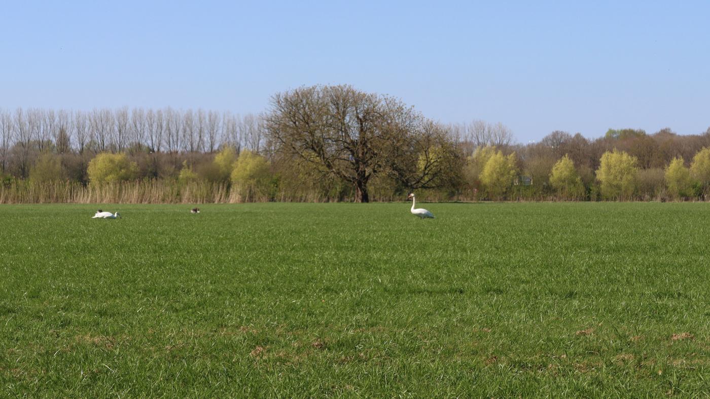
The field next to the Hoge Bospad.
The walking route passes through part of the area of the New Dutch Water Defence Line: a 200-kilometre-long defence system hidden in the landscape. The water defence lines, of which the New Dutch Water Defence Line is a part, are a collection of defensive works that protected the eastern part of the Netherlands from enemy troops. “The principle behind this? Very simple. By flooding the land so that enemy troops could not move through it easily: too shallow to sail through, too deep to wade through,” says a female voice in the audio tour. Where the land was too high, forts and other military structures were built.
Colonial past
The audio tour continues through the Hoge Bos, which opens onto a field. In the background, tall buildings such as student flats Johanna and Casa Confetti and the Van Unnik-building are visible. Meanwhile, we hear the story of King William I, who ordered the construction of the New Dutch Water Defence Line in 1815.
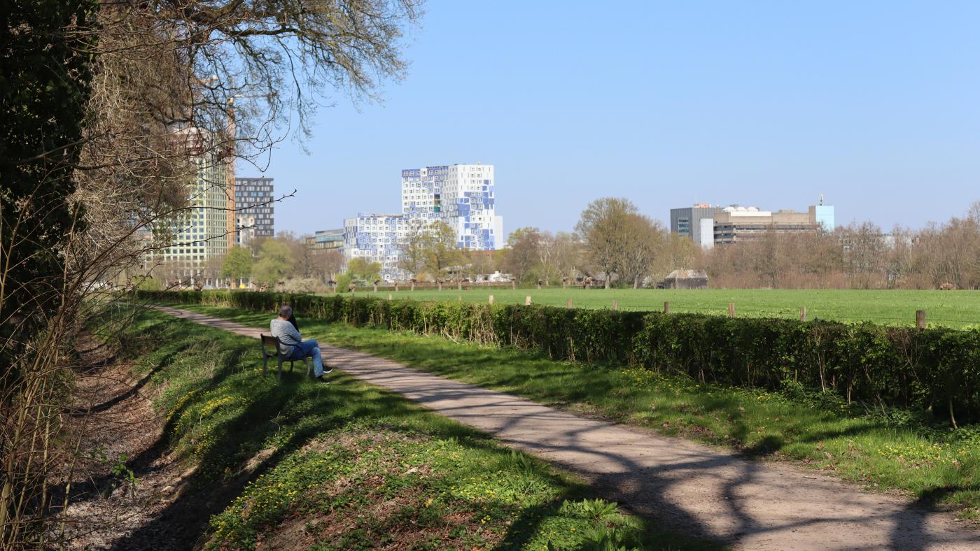
From het Hoge Bos you get a good view at the buildings of USP
The history has a dark side, we hear. William I founded the Netherlands Trading Society (de Nederlandsche Handel Maatschappij) to promote trade between the Netherlands and its colonies, particularly the Dutch East Indies. The expensive defence line could have been financed with money from the Dutch colonies.
Endangered species
The next destination is the fort at Rijnauwen. The largest fort of the Dutch Water Defence Line is hidden among the trees and bushes on the banks of the Kromme Rijn. The fort was given back to nature after the Second World War and is now a place of rest for roe deer, badgers, foxes, buzzards and hawks.
Further on in the fort, bats take shelter. This year, 453 have been found. That is a lot, considering that bats are on the list of endangered species. “The tranquillity and the specific construction of the forts make this a super suitable place for bats. Not only as a wintering place, but also as a swarming place and for the mating season, they can be found here,” says the narrator.
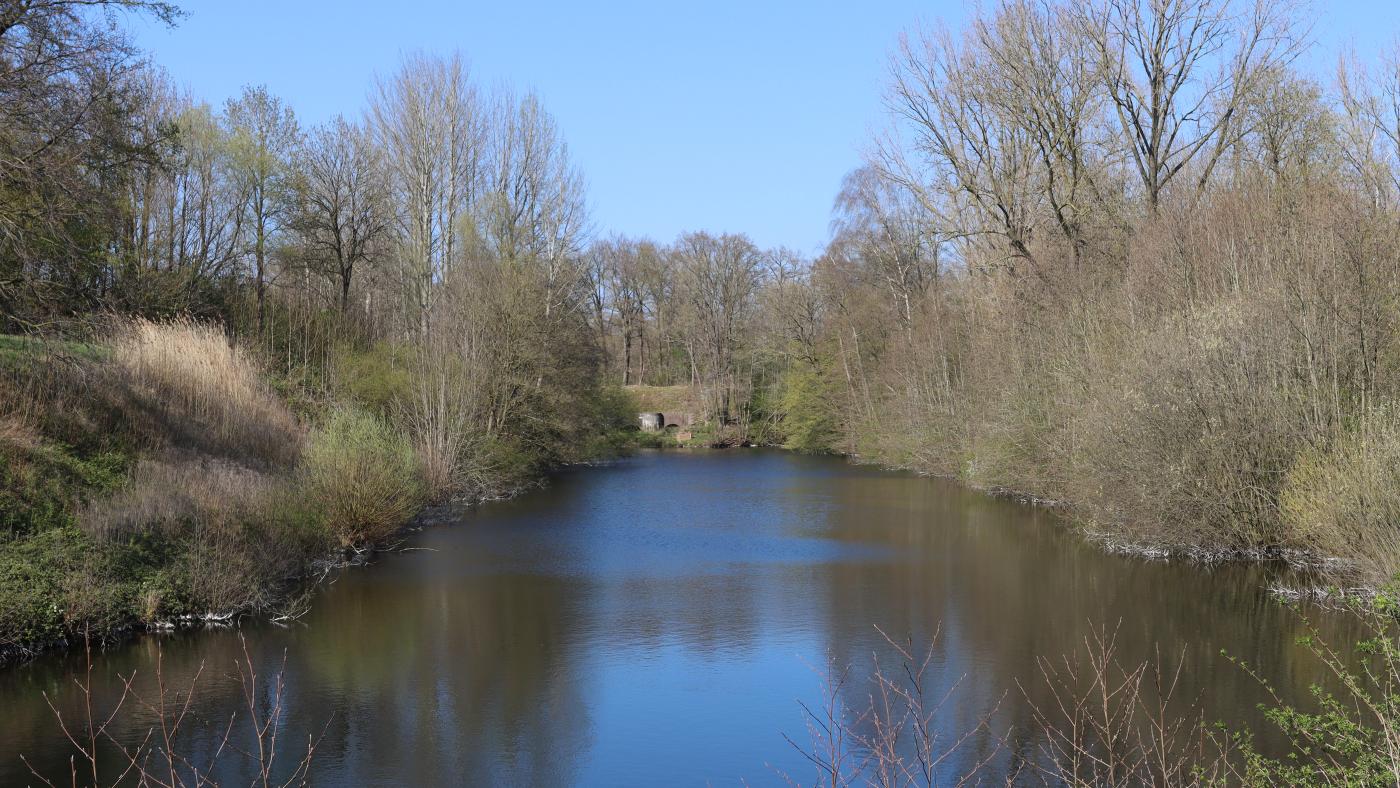
Fort bij Rijnauwen is a very suitable resting place for bats due to its hidden location.
Unobstructed view
On the Vossegatsedijk, along the water's edge of the fort, a kingfisher with its striking orange breast suddenly appears on a low-hanging branch. Its cobalt blue back glitters as it shoots away from a passing cyclist.
The route then continues along a tank barrier – bars in the ground designed to stop tanks – back to Utrecht Science Park. Between the buildings on Heidelberglaan, it is difficult to imagine that the campus used to be open land. “From 1853 to 1963, the Ministry of War stipulated that there had to be a clear line of sight and firing range around the defensive works, such as Fort bij Rijnauwen. This allowed you to draw imaginary circles of 300, 600 and 1000 metres around these areas to determine whether, what and how building was permitted within these circles.” The Utrecht Science Park also falls within this area.
The Hoofddijk
We continue to the Hoofddijk, which lies between the sports fields of Olympos and the David de Wied building. The path was ‘once a raised road in a landscape that could be flooded’. Adjacent to this are the Botanic Gardens, a green oasis where Fort Hoofddijk is located. The fort was built in 1879.
While Fort Rijnauwen is a place for flora and fauna, Fort Hoofddijk has been given over to science. Today, it houses the Paleomagnetic Laboratory of Utrecht University, which conducts research into the Earth's magnetic field. This must be done in a space where there is no metal present. The old gunpowder chambers are ideal for this purpose, as they were built without metal to prevent sparks from igniting the gunpowder. After more than an hour's walk, this is also the end of the route.